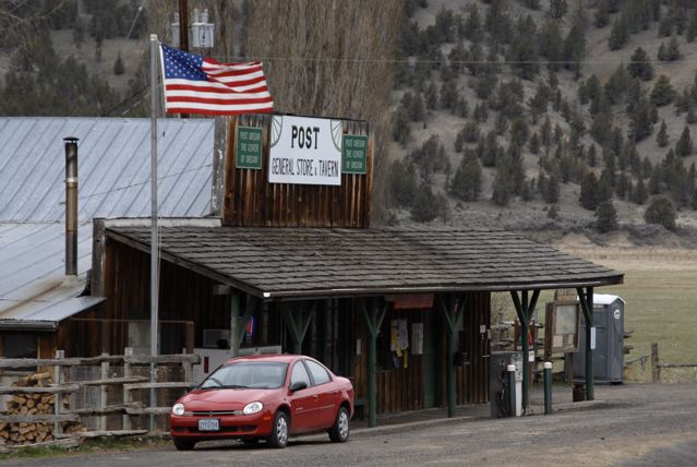
“Have you been to the geographical center of Oregon?”
Marvin’s question seemed innocently proposed but I knew better… he likes to use leading questions to start a conversation and it is likely that he already knows the answer. We were in Central Oregon, defined by three counties, Jefferson, Crook and Deschutes. We had passed through Jefferson County and now we were in Crook County, east of Prineville and headed toward Post and Paulina on SH 380. I suspected his question involved one those two communities so I decided to be indirect and answer with a question.
“I wonder how they calculate the center of a state… Oregon’s almost square so it would be easy to get a rough estimate by marking diagonals and see where they cross.”
“When I did that the diagonals crossed pretty close to Post,” replied Marvin.
In the past I did some computer based research. A U.S. Coast and Geodetic Survey (USCGS) put the center of Oregon about 16 miles south of Post, but not near any community. Although, in remote Oregon 16 miles is considered nearby… some ranches out there are bigger than that.
A Center of Gravity method put the center south of highway 20 in Deschutes County, a few miles from Millican, about 30 miles SW of Post, but Oscar Adams, the senior mathematician for USCGS, ridiculed the question and said there is no such thing as a geographical center of any state, country or continent. He claimed there was no exactitude in any of the methods used. “Make your own definition of center,” he said, “one is as good as another.”
Methinks he doth protest too much. He had a reputation for accuracy to uphold and he probably was embarrassed by telling people he couldn’t provide an exact answer.
I tried a more modern solution in reverse… I used Google Earth and put the center cross-hairs smack dab on Post, then zoomed out until I had the boundaries of Oregon on screen. With a little fudging Post looked pretty good for the center of the state. Then I did a Google map search for “Oregon” and looked at the icon’s location… it’s a few miles east of Brothers, Deschutes County, about 25 miles south of Post, but still in Central Oregon.
Alfred Korzybski’s famous statement: “the map is not the territory” holds true… it is impossible to map a three-dimensional sphere onto two-dimensional paper without creating some area distortions, thus no exact center is possible. The map is the problem.
“Marvin, I’m hungry. Are you ready for lunch? I hear the store in Post makes an excellent meatloaf sandwich and I want one of those t-shirts that claim Post is the geographical center of Oregon.”
For more traveling Oregon stories: http://www.countrytraveleronline.com/
byLarry

