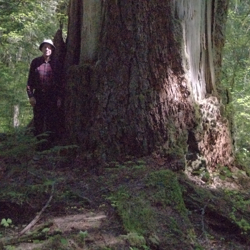
Ralph Anderson wanted to show me some big trees. We were buddies in high school some 56 years ago. We recently renewed the friendship and found we had a mutual interest in botanical things. Yesterday we set out on an adventure. He knew of a grove of old growth trees where several had nominations as the largest trees in their species. The added attraction for me was the location was on the Clackamas River, one of my favorite drives.
Before you start up the Clackamas, before you leave Estacada, you should do several things. Stop at the Clackamas River Ranger District office and purchase a map of the Mount Hood National Forest. Forest roads can be complicated and a good map could save you from getting lost in a maze of roads. Top off your fuel tank before leaving town. There are no fueling stations for many miles once you leave Estacada and beginning with a full tank may save you a long walk through unpopulated area. It’s also a good idea to have an axe, a shovel, and a bucket in your car. Forest roads are usually not maintained and you may need to clear the path of downed trees or fallen rocks. I usually have drinking water in the car… I buy a carton of those plastic water filled bottles and when I start a hike I put one or two in my backpack. Stay hydrated and your hike will be more enjoyable.
We departed Estacada to the southeast on State Highway (SH) 224, headed up river. Be sure and stop at some of the many pullouts and enjoy the scenic views of the Clackamas River. SH 224 ends just a little past the Ripplebrook Guard Station but the paved road continues as the Primary Forest Route (PFR) 46. Beyond this point the road is not plowed during winter so as elevation increases you may find snowdrifts blocking the route even as late as June. If you find snow I recommend turning around and heading back the way you came. Cell phone coverage ends just a few miles upriver from Estacada so you may be on your own except for occasional travelers or loggers. If you choose to proceed the shovel you put in the car may be useful.
Primary Forest Routes are numbered with two digits. The route we followed after Ripplebrook was PFR 46, a good paved road that eventually ends up at Detroit, over in the Santiam River drainage, on SH 22. Branches (secondary forest routes) have four digit numbers. The branch we were looking for was SFR 4670. After finding our road we crossed the bridge over the Clackamas then turned right on a spur road. From this point it would be a good idea to have a guide to find the big trees. The trail is not well marked, is rough and brushy. We hiked about six miles round trip so you might rate the hike as strenuous. It would be difficult to get lost because you only need to follow the river back upstream to the bridge but for efficiency it is good to be with someone who knows where the trees stand.
The big trees were magnificent. Several species here, notably cedar and fir, have had nominations as the largest of their species. We don’t have many of these big trees left so it is a privilege to visit and marvel at them. You might notice how quiet it is in this grove. Birds seem absent and the only thing that breaks the silence is the ripple of rapids in the Clackamas, the wind in the trees, and the occasional roar of a logging truck using PFR 46. During the hike to the grove we did hear the drumming of grouse and the call of a very vocal owl that we probably disturbed from its daytime snooze.
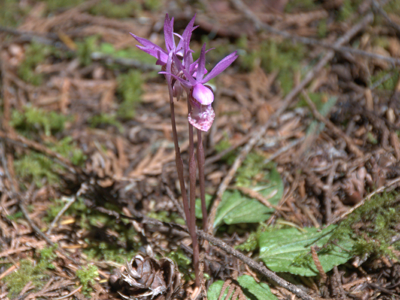
Several spring wildflowers were in bloom, notably a delicate (and small) orchid called a Fairy Slipper (Calypso bulbosa).

All in all it was a very good outing.
byLarry

