Ribes howellii

September 21, 2007: Gresham, Multnomah County, Oregon: Chris, Lucy and I were determined to drive to Wahtum Lake, Hood River County, OR, and take an afternoon hike in the wilderness area near the lake. You can start at the Eagle Creek fish hatchery near Bonneville Dam and hike thirteen miles uphill along one of the most spectacular trails in Oregon or take the easy route by driving to Wahtum Lake. We preferred the latter choice today.

We drove through the town of Sandy on Highway 26, eastbound to the Lolo Pass road. The road climbs a ridge adjacent the western flank of Mount Hood. It is mostly paved, one lane, but cracks and sags in the pavement indicate the temporary nature of mountain roads. It gives pause to the idea of driving an 8,000 pound vehicle over such unstable terrain. We tried to keep to the uphill side of the road as much as possible.
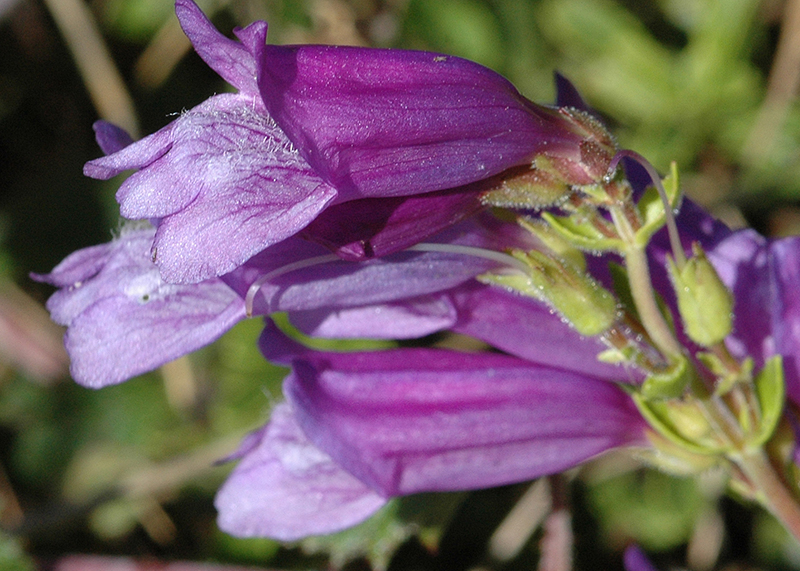
Penstemon, Lolo Pass
Penstemon Lolo Pass road 9/21/2007 Clackamas County

We stopped to look at bright magenta penstemon growing roadside.

The road follows under Bonneville Power lines most of the way. The pop, crackle, and snap of electricity surging through the wires overhead caught our attention and makes one wonder what the effects might be on the human body.

The sound of gunshots interrupted our reverie. Deer season is near and we imagined someone might be sighting in their rifle but the shots were too rapid.

At one of our favorite stops along the road someone had dumped an old computer, complete with monitor, then used the dump for target practice. Perhaps here was the source of the shots we heard. Judging from the number of road signs that were shot full of holes it might be dangerous to travel along this road anytime.

We met several vehicles traveling the opposite direction. The road is basically one lane with pullouts but we had no problem passing oncoming traffic.

Breathtaking views of Mount Hood are numerous. At this time of year the blanket of snow usually covering the mountain is absent although broken glaciers remain. We wondered what happened to the climbers that disappeared making an assault on the north face last winter and wondered if their bodies will ever be found. They may have tumbled into one of the many crevasses and not be found for many years, if ever. The heroic search effort transfixed the nation for several weeks until severe winter weather zeroed all probability of survival. The lives of the would be rescuers became endangered so the search was called off.

Eventually we descended the Hood River side and found the road we needed to reach Wahtum Lake. The parking area is ten miles from the intersection, a fee area maintained by the US Forest Service, whose daily use costs ten dollars. The receptacle was wrapped with black plastic and securely taped so we assumed parking is free after the tourist season.

We parked the truck alongside several cars and headed down the trail passing through old growth forest. Portions of the lake are visible between the trunks of trees in the old growth forest. Barrel shaped cones from the tops of Pacific Silver Fir (Abies amabilis) litter the trail, the work of ambitious squirrels who harvest the cones and stash them for a winter food supply.

The trail is an old road bed and provides easy walking. A gate blocked access for wheeled vehicles but we saw tire tracks as we walked. Someone has access to the road.
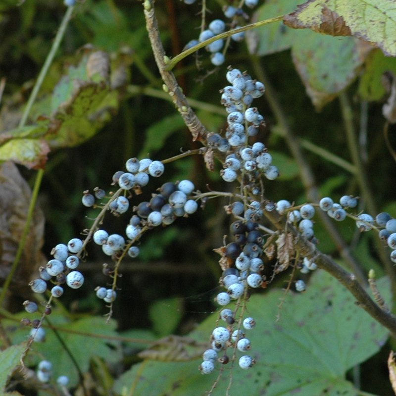
Ribes howellii
fruit of Maple leaf currant (Ribes howellii) Whatum Lake 9/21/2007 Hood River County

Wet seeps exhibited flowers and butterflies (mostly California Tortoiseshells). We found pale blue berries of Maple leaf currant (Ribes howellii) but declined a taste test. Our plant guidebook claims they are unpalatable and we will take their word. Bright red bane-berries known to be highly poisonous are numerous and might tempt the unwary.
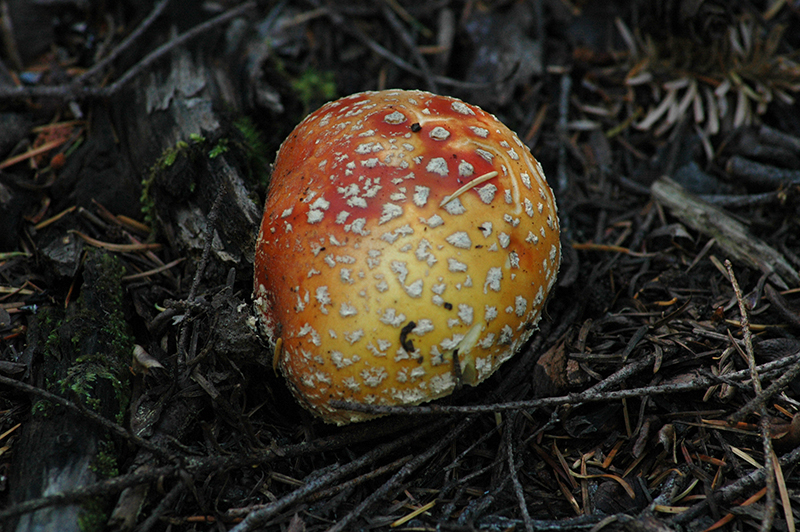
Amanita muscaria
Mushroom (Amanita muscaria) Wahtum Lake 9/21/2007 Hood River County

Many mushrooms grow along the road also, but we took pictures and left them undisturbed. Occasional whiffs of rotten meat assailed our nostrils but we were unable to locate its source. Finally we decided perhaps the odor came from one of the mushrooms. I suggested to Chris that he pick up a broken piece and take a sniff but he declined. Lucy paid no attention to the odors, perhaps animal instinct guided her to leave the poison alone.

After a couple miles on the old road bed we came to the Anthill Trail leading back to the parking lot. We chose to make the loop. Trees have fallen across the trail giving evidence of a wind storm recently. Anthill Trail proceeds along a knife back ridge for a distance, offering wonderful scenic views of the Columbia Basin to the east and Wahtum Lake to the west.

byLarry

Related Images:

Road Trip, Blue Mountains, OR

September 5, 2007: Summit Road, Union County, OR: Chris and I were on a road trip, roaming forest service roads in the Blue Mountain Region of eastern Oregon. We decided to camp for the night beside a small lake off Summit Road near Tollgate. Clouds threatened rain so we put up the tent. We didn’t get rained on but we awoke to thick fog and the rumble of vehicles, archery hunters, passing by on the road near our camp.

While we were packing our gear a pickup pulled up, two camoflage-clad hunters inside. They wondered how we were doing so we chatted about hunting for a few minutes. We had not seen elk or heard elk bugling. None of the camps we had passed had any meat hanging so I’m guessing hunting wasn’t good. Hunters were driving the roads hoping to spot something instead of getting out in the brush and stalking their game.

After packing up our camp we headed south along Summit Road to I-84 then after a jog east on I-84 followed the Grande Ronde river upstream, passing Starkey and drove south  to Granite. From there we took FSR 10 to Olive Lake and eventually joined with US 395 south of Ukiah. Our road map indicated a secondary (gravel) road followed the North Fork of the John Day River to Monument. We hadn’t been that way before so elected to see some new territory.

The drive started well. The river is scenic but with passing each inhabitance the road got progressively rougher. Finally at the intersection with FSR 15 the road became more of a trail. What passed for a road had the look of having recently been scraped by a bulldozer and there were no culverts or bridges crossing creeks draining into the John Day.

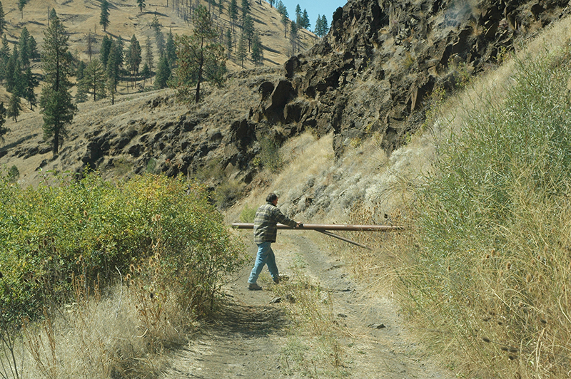
Road blocked by gate
North Fork John Day River road gate block Grant County, Chris checking the gate.


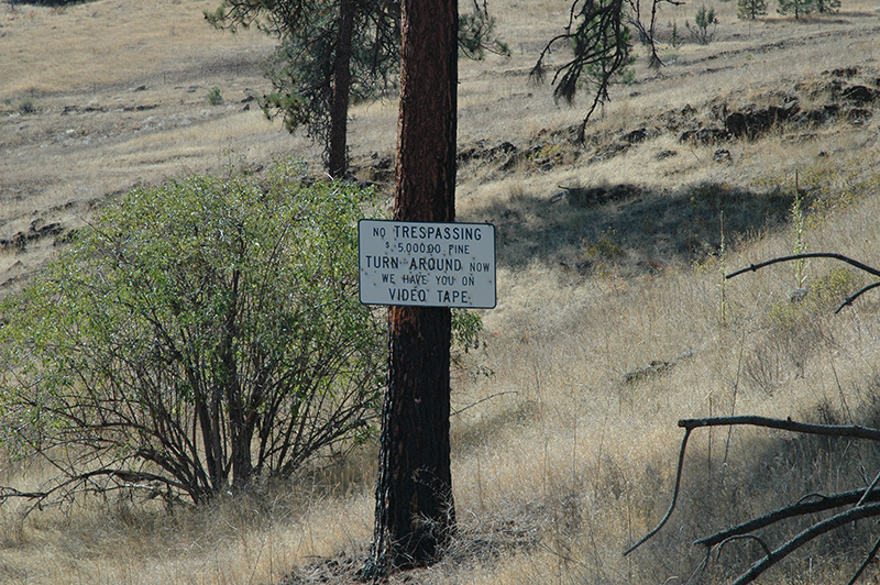
Private Property
North Fork John Day River Warning sign 9/5/2007 Grant County

Finally we came to a gate barring the roadway and a sign that threatened financial harm to anyone who would dare to continue. What a revolting development that was. The sign was enough of a hint for us. We backtracked to FSR 15 and rejoined US 395 at Ritter. At Long Creek we turned west on highway 402 and headed for Monument.

We stopped at the US Forest Service office in Monument. There we were told that the North Fork road crossed private land and some of those landowners had chosen to shut off access. The Forest Service had been up there fighting fire and had “improved” the road so they could move their heavy equipment. That explained the cat tracks and blade marks in the road.

We didn’t know if it was legal to deny the public right of way but we weren’t about to assert that right out in the field. Maybe one of our US Senators can answer the question for us.

The rest of the trip home was uneventful and took place on paved highways.

byLarry

Related Images:

Hunting Opuntia x columbiana

September 4, 2007: Camping at Dug Bar, Hell’s Canyon, Snake River, Wallowa County, OR: The night was almost too warm for sleep. The rocks radiate heat stored by the sun during the day so wrapping up in a sleeping bag was overkill. Chris, Lucy (dog) and I were camped at Dug Bar, alongside the Snake River, deep in Hell’s Canyon.

Lucy is used to camping and remained curled up in her bed while it was dark. The call of an owl during the night did not disturb her. Early morning though, at first light of day, something caught her attention and she barked a warning.

Awakened by her bark… Finally we spotted the culprits… five deer were descending the hill across the river. At her bark they took up watchful stances. We could hear their snorts of alarm. It was interesting to note that three of the deer looked in different directions, facing outward like the three corners of a triangle. Lucy’s bark echoed off the canyon walls so the deer may have been unsure where the threat was coming from. They wouldn’t be denied their drink of water so eventually they came to the river bank. Then they headed back up the ridge traveling single file, making the climb up a near vertical canyon wall look easy.

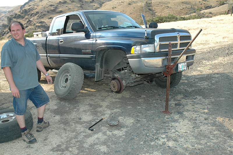
Flat tire, Dug Bar
Chris Rea Changing tire Dug Bar

Chris had bad news to report. We had a flat tire on the truck. After packing our gear we changed the tire. Thankfully the spare held air pressure.There’s nothing much worse than a flat tire unless it is two flat tires.

We decided to head directly for the Les Schwab tire store in Enterprise and either buy new tires or get this one repaired. We hoped also that we would not have a second flat. Rock roads are tough on tires. We would breathe a sigh of relief once we were back to the main road where we had a chance to get help if we had another flat. In the canyon, at Dug Bar, our only contact would have been one of the jet boats. It might have been a long wait for a rescue vehicle to join us.

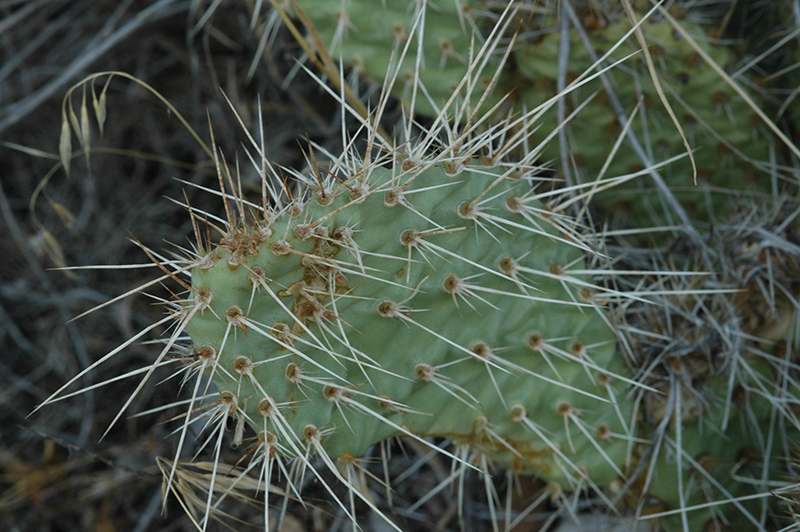
Prickly Pear Cactus
Opuntia x columbiana (Prickly Pear)

Along the road to Dug Bar you might notice Prickly Pear Cactus (Opuntia x columbiana)… apparently this plant is a hybrid between two species.

The Les Schwab tire store recommended a repair on our flat tire which they accomplished at no charge so we were back on the road in short time.

Due to the lateness in the day we decided to camp for the night back at the pond near Summit Road where we camped before. It was cloudy and threatened to rain. We did see flashes of lightning and heard distant rumbles of thunder so we prepared to get wet.

byLarry

Related Images:

Dug Bar, Snake River, Wallowa County, OR

September 3, 2007: Dug Bar, Hell’s Canyon, Snake River, Wallowa County, OR: We left our campsite near Summit Road early in the morning and proceeded to Elgin, Enterprise, Joseph, and Imnaha. The road to Dug Bar heads north from Imnaha.

Immediately a sign warns that six miles ahead the road becomes unsuitable for trailers and larger vehicles. Another warning coincides with the end of pavement as well. At that point the road sign states that the road ahead is not recommended for passenger vehicles.

The scenery is spectacular so take the opportunity to stop wherever you can. It took us four hours to reach Dug Bar, in part because of road conditions and in part because of many stops to admire the scenery. The road is not for the faint hearted. In many places the edge drops several thousand feet nearly straight down and there is no room to pass another vehicle. I drive a Dodge 4WD pickup with a low range (very slow) gear option. That means I have lots of power for hill climbing and I can approach rough, rocky road very slowly. Twists and turns in the road are sharp enough that the turn radius of the truck could barely make the corners in one effort.

We decided to camp at Dug Bar rather than return to Imnaha facing into the setting sun. It was a great decision. It was warm enough in the canyon that any exertion caused the sweat to pour. We had the campground entirely to ourselves and other than a passing jet boat we saw no one else.

The campgrounds were trashy… the outhouses needed cleaning… spent shotgun shells littered the ground… clearly the place needs some attention. Still, we enjoyed the overnight stay and our experience was enhanced by seeing both a sunset and a sunrise at such a beautiful location.

byLarry

Related Images:

Grindelia nana

September 2, 2007: Meacham, Umatilla County, OR: It was Labor Day weekend and Chris and I had decided to brave the holiday traffic. We were headed for Dug Bar on the Snake River 30 miles north of Imnaha, Wallowa County, OR.


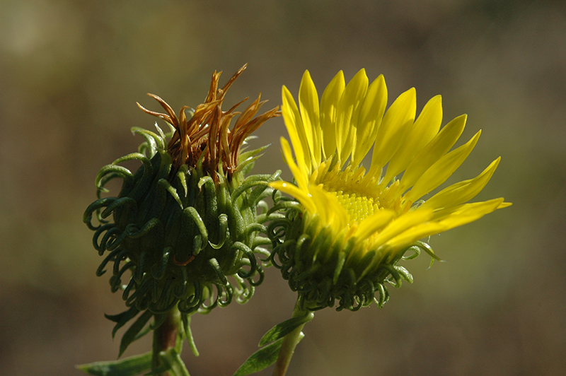
Gumweed
flower Gumweed (Grindelia nana) Meacham exit 9/2/2007 Umatilla County

We stopped at the Meacham exit in the Blue Mountains to give Lucy a break and stretch our legs. This gumweed plant (Grindelia nana) greeted us roadside.

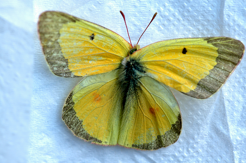
Colias philodice
Clouded Sulphur Butterfly (Colias philodice) Meacham exit 9/2/2007 Umatilla County


The dodge collected a yellow butterfly in the grill. We identified it as a Clouded Sulphur (Colias  philodice).

At the crest of the ridge we took the exit to Summit Road and followed FSR 31 for a forty mile drive across to the Tollgate highway SH 204. It is a delightful and scenic drive but is gravel most of the way. We planned to camp for the night at a roadside pond where Chris could do some trout fishing and I could look for wildflowers.

After seeing many camps along the route we realized a hunting season was in effect and we would be lucky to find a camping spot. Fortunately we had our favorite camping spot to ourselves and we settled in for the night.

Chris did some fishing and caught a few trout (released). Trout were rising to a bug hatch but didn’t seem anxious to take flies or lures. The pond is small and standing near the middle Chris could cast to either end. As evening progressed small bats came out and skimmed the surface of the pond in their frenetic search for insects.

Finally, we watched the sun set in a fiery red display, coloring dust and smoke particles in the atmosphere. We heard quite a number of gun shots that seemed patterned… two quick shots followed by a single. Either they exhausted their supply of ammo or the desired result was achieved. Other than an occasional high altitude jet passing overhead the rest of the night was uneventful.

byLarry

Related Images: