Aurigid Meteor Shower

September 1, 2007: Gresham, Multnomah County, OR: Hearing a call from Nature at 4:15 this morning and realizing that the Aurigid meteor shower was supposed to peak about 4:30 I decided to take Lucy for a nocturnal walk and watch the expected shower of meteors.

The night sky was clear, the waning moon was shining brightly and even though there was a bit of chill in the air I was comfortable in a long sleeved shirt and jeans.

To my amazement automobiles passed through the intersection near our house nearly as often as during the day. The neighbor’s horses were whinnying to each other and I could hear several roosters crowing. Perhaps the city lights of Portland confused the chickens into thinking the sun was coming up. The neighbor up the road raises hounds and they were putting up a ruckus, perhaps just baying at the moon, or perhaps the horses and roosters disturbed their sleep.

Scientists predicted several hundred meteors per hour but waffled a bit saying no one really knew. These meteors were castoffs from comet Kiess in orbit around the sun with a period of once in 2,000 earth years. I don’t know about the rest of the region but I saw four meteors in approximately an hour… maybe I had just received the Kiess off.

byLarry

Related Images:

Gomphus kauffmanii

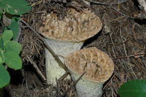
August 28, 2007: Cone Mountain, Linn County, OR: Marvin and I were saying farewell to spring. We drove to the parking lot at the base of Iron Mountain and took the Cone Mountain trail. It was a warm late summer day on the calendar but at this elevation spring starts late and runs into the summer days found at lower elevations.

Almost immediately we met two hikers but would meet no more. We had the trail to ourselves. They were kind enough to tell us about some unusual looking mushrooms they had seen and gave us enough location clues that we spotted them also.

Marvin managed to identify the species as Gomphus kauffmanii using the help of a friend.

There were still quite a number of flowers in bloom and the day was interesting.

byLarry

Related Images:

Parnassia fimbriata (Grass of Parnassus)

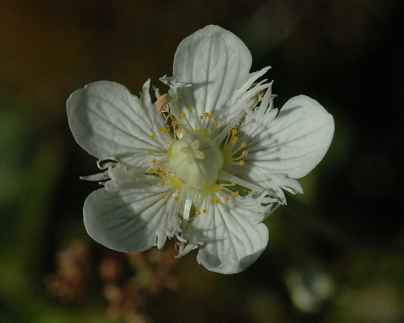
August 22, 2007: Round Lake, Marion County, OR: On a spur of the moment Chris and I decided to take a drive into the mountains and check out a seep where we go occasionally to look at wildflowers. This is late in the season so we didn’t expect to find much. I was very pleased to find Parnassia fimbriata (Grass of Parnassus). Not uncommon yet I had not seen it before… maybe because it blooms late in the season or maybe because it is not common locally.

Parnassus fimbriata
white flower of Parnassus Grass (Parnassia fimbriata)

byLarry

Related Images:

Slide Lake, Lake County, OR

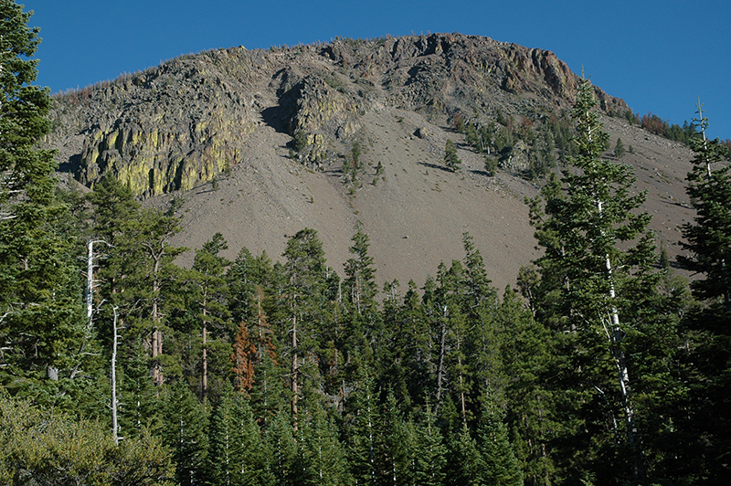
Slide Mountain
Slide Mountain 8/3/2007

August 16, 2007: Slide Lake, Lake County, OR: Slide Lake is located near Slide Mountain at the south end of Winter Rim in the Fremont National Forest. It’s a small lake, I doubt it covers an acre, and shallow with bull rush covering one end. In a few more years it will be another mountain meadow. It’s a few hundred feet from a forest service road but if you don’t know where it is you will drive by without seeing it. Above the lake, in a grove of lodgepole pine, there is a delightful place to camp. There is no formal campground with toilets and drinking fountains. Sorry.

Chris and I arrived last night just before dusk with barely enough time to set up the tent and fix dinner. After eating we sat in the gloaming and watched bats forage for insects. At the first hint of evening the bats are high in the sky, but as evening progresses they descend. When it is almost too dark to see they are flitting around near ground level.

We also watch the stars pop out as the night sky appears. We can see satellites orbiting the earth and an occasional airplane, the high altitude jets, bound on the north/south track. They are nearly inaudible so their distant rumble isn’t a bother. We have no neighbors to annoy us and we wonder at the night sounds around us. Some kind of owl is out hunting… when I get home I’ll listen to the bird sounds CD I have and see if I can identify the owl. It’s a very pleasant place to spend the night.

With first morning light we are up. Lucy, our family dog, wouldn’t let us sleep any longer. She is anxious to go for a walk so we accommodate her. We perk a pot of coffee and have our breakfast oatmeal cookie. We tear down the tent and pack our gear one more time.

Today we will head for Silver Lake to talk to the National Forest Botanist for this region then head across country from Fort Rock to Millican. That will end the back country road exploration for this trip.

Out of Fort Rock we are met with a sign that declared our chosen path to be a dead end so we elected to try plan B. I drove past the exit thinking it was an access to a hay field but Chris insisted it was our road so we returned for a better look. It was our road and as the sign warned “This road is not maintained and is primitive.” It is not a wet weather road but fortunately they don’t have much wet weather in this area. It’s dusty, rocky, and bumpy but we managed to find our way to Millican. From there it is paved highway all the way home.

byLarry

Related Images:

Hawk Valley, Harney County, OR

August 15, 2007: Hawk Valley, Harney County, OR: Having successfully negotiated the descent of the “hill climb” and intersected with the Long Draw road, Chris and I proceeded NW toward Hawk Valley. Hawk Valley, Hawk Mountain, Hawksey Walksy Lake… what were they thinking?

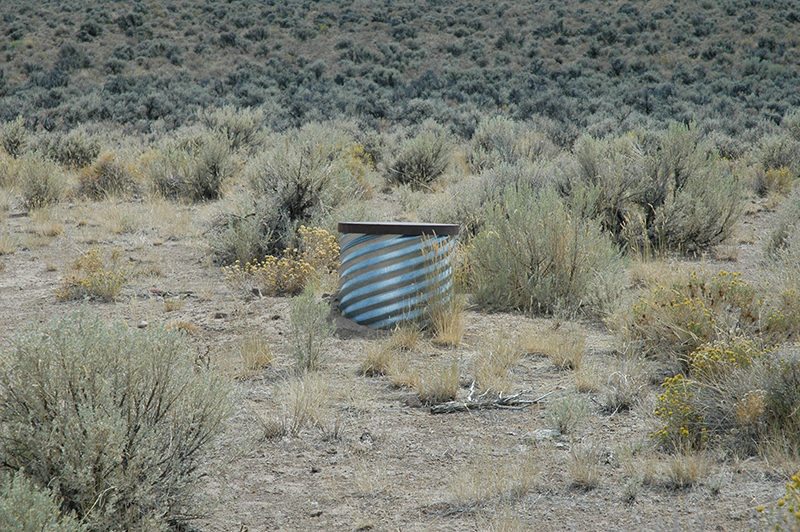
Stand Pipe
Stand Pipe in Hawk Valley

Once in Hawk Valley you might notice a curious thing. A series of standpipes follow roadside for several miles. The pipe must be about two feet in diameter and sticks up maybe 18 inches above the ground. An occasional watering trough in near proximity leads one to believe this might be a water pipe. To the northwest, about as far as you can see, a large storage tank sits at the base of Acry Mountain. We didn’t see any livestock and none of the watering troughs contained water.

Several spur roads exist in this area. One of those thin red lines on the map heads toward Lone Mountain and may connect across the ridge to the Domingo Pass road. Next trip we will do some exploring.

Near the base of Acry Mountain we find a closed gate barring the road. We proceed, making sure to close the gate behind us.

We briefly discuss following 6176 north in a loop around Beatys Butte but our time is limited so we head SW instead, back to US 140 at the Oregon/Nevada border. We met three men on ATV’s, hunting antelope. They aren’t having much luck. But before we reach the highway we surprised one in the road as we came over a slight rise… it didn’t wait for us to take a picture.

Back on the highway, after completing 60 miles of remote country driving in the past five hours, we opened up the throttle and the windows, blew out the accumulated dust, and headed for Slide Lake where we intended to spend the night.

byLarry

Related Images: